top of page

Envision the Future
Connected ADAS
EnGIS eHorizon Engine
Data creation, conversion and processing
EnGIS converts HD map data and ADAS map data to create eHorizon
based on an OEM’s proprietary format.
Our eHorizon Solution provides the converted engine required to create
the application.
eHorizon constructor
The EnGIS eHorizon engine provides the features and predicted data required
to implement eHorizon. This includes cloud, data prediction, data delivery
and collection which enables EnGIS to act as a constructor.
Reconstruct API
EnGIS implements navigation, ADAS, lane keeping system
and more through the collected data.
eHorizon integration
EnGIS reconstructor integrates the functions cloud, data prediction,
data delivery and data collection.


Features and Benefits
Our data conversion solution is flexible to deliver the data to eHorizon reconstructor
such as navigation and ADAS
Possible to compose optimal data for eHorizon engine to use
Provide accurate and up-to-date map data by NDS incremental map update
Supports OEM proprietary formats including ADASIS V2 / V3 protocol to enable applications
EnVision
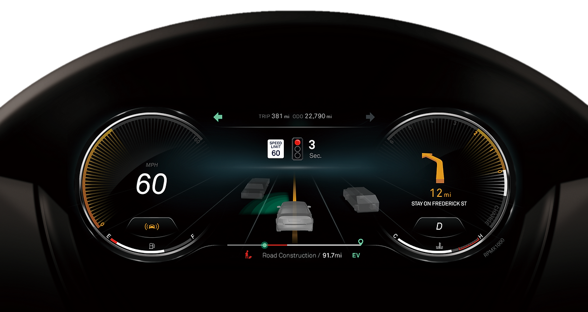
EnGIS uses the SD/HD map to bring ADAS benefits to the automotive driving experience.
Our high performance graphic UX tool alongside navigation identifies lane-level vehicle positioning and gives guidance on upcoming maneuvers by visualizing the data from ADAS sensors and V2X on the instrument cluster to improve safety and deliver novel driving experiences.


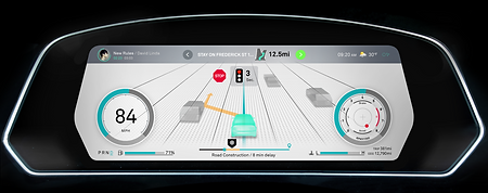
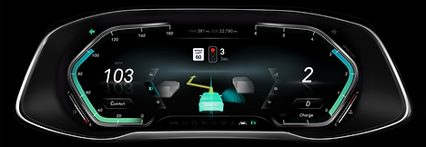
Intelligent Speed Assistance (ISA)
ISA uses an onboard speed sign-recognition camera and/or GPS-linked speed limit from map data to inform drivers of the current speed limit. An electronic horizon function can provide the driver with the speed limit of an upcoming road so that the driver and the vehicle can adjust the speed in advance. EnGIS has deployed solutions for ISA using current road speed limit information and also offers an e-Horizon solution for upcoming speed limits.

• Car identifies the current speed limit using either:
– Front facing onboard camera
– and / or car receives position from GPS /
dead reckoning sensors and obtains the
current speed limit from digital map.
• Speed limit is displayed on the dashboard
• ISA function helps the driver
to keep within the legal speed limit
Download White Paper

Intelligent Speed Assistance (ISA)
As the automotive industry prepares itself for the introduction of regulation on speed limits in Europe starting in 2022, this paper discusses the background to the need for such regulation and outlines some technical implementations of camera and map-based solutions. The challenges facing camera solutions are described in detail as well as recommended implementations of a camera and map-based solution. The implementation of an EnGIS electronic horizon to improve the ISA function for upcoming speed limits is explained along with the need for ensuring fresh maps using an OTA platform such as the end-to-end EnGIS OTA solution.
bottom of page